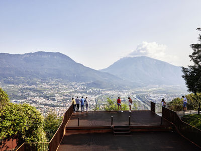
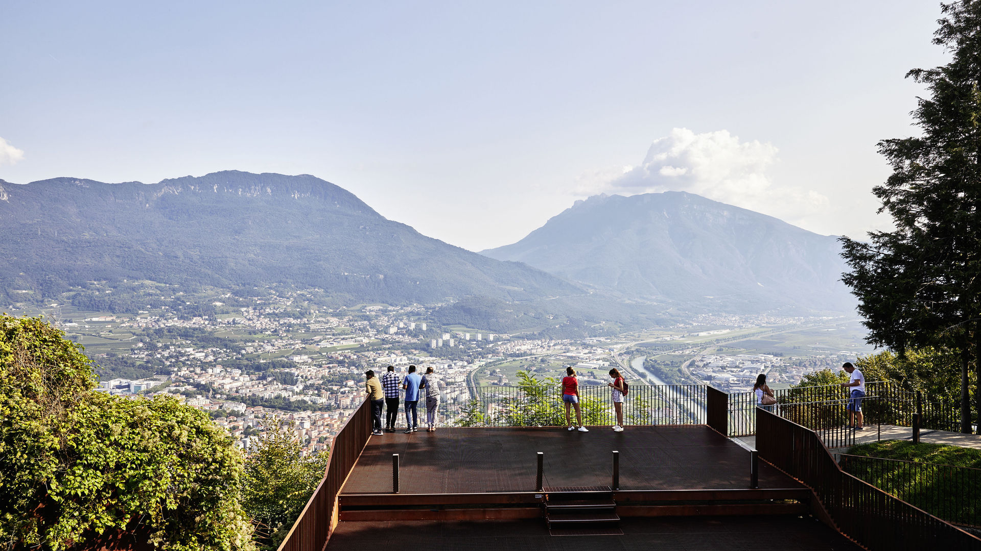
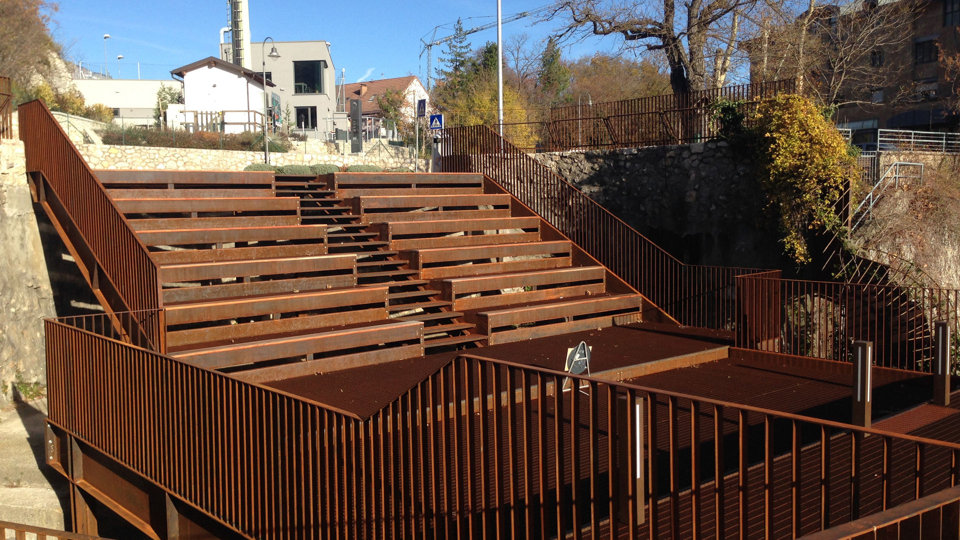
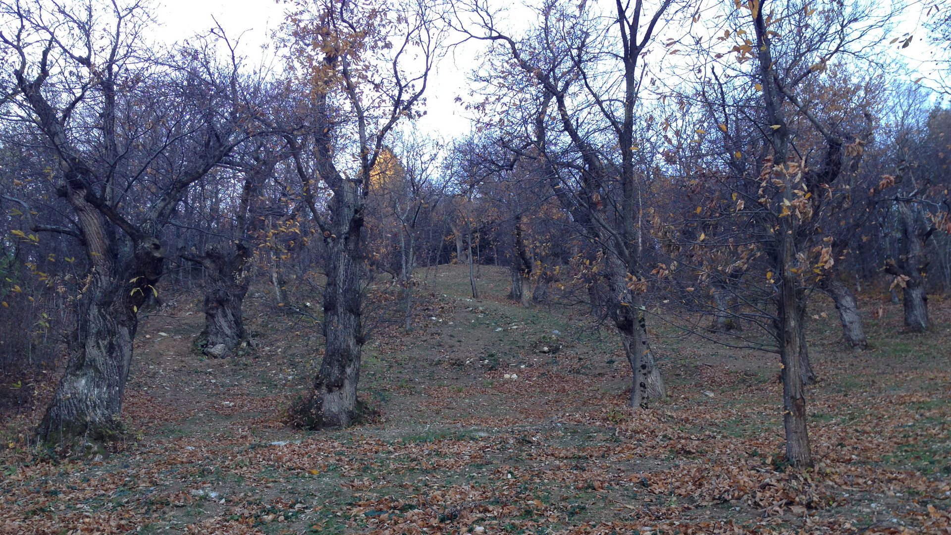
This itinerary can start in the town of Sardagna, or in Trento, using the cableway, which is the equivalent of an urban bus line. The description begins from the station at the top of the cableway, in Sardagna. From the piazza you can enjoy a beautiful view over the city of Trento, from atop a weathering steel structure, which leans out towards the precipice, and also equipped as a small open-air theatre. You then walk down towards the town, following provincial road 85, without heading for the centre, and following the signs for “Passo Camponzin”. You follow via del Ronco d’Andrea. Having returned to the provincial road, on the right a small road heads downhill, leading northwards through cultivated fields, where wooden “urban trekking” signs indicate the route to follow. A short climb takes you through the woods, now on a mule track, until you reach a farmed plot of land with a house. Continuing along the road, still northward, you reach a fork in the road. To the right, through the woods, you soon reach Parco de le Poze, a beautiful chestnut forest with a panoramic view of Valle dell’Adige. When you return to the fork in the road, you turn right and reach the provincial road, which you follow uphill to the first of the 7 Hairpin Bends, where a small road leads off to the right. You come to a wider section of the road where a small trail leaves on the left, and soon leads to a stopping area with two dilapidated houses and a chestnut forest above. After climbing to the fifth hairpin bend via a trail, you encounter the signs indicating, on one side, Passo Camponzin, and on the other the continuation of the Sentiero dei Castagni [Chestnut Route]. You cross the provincial road and follow a small road downhill, to the South-East, and after passing through a valley you reach a fork with signs for Candrai. You take the path on the right and climb through an ample chestnut forest, until you reach a dirt road. You follow the signs for Candriai, which lead you to follow a dirt road, also in a south-easterly direction. After two wide bends, in an environment characterised by beautiful specimens of chestnut tree, you continue along the provincial road, ignoring the various turn-offs. Going downhill, you reach a fork on a bend, characterised by a cross, where you continue to head downhill, passing the inlet for an aqueduct, and at the fork below you take the paved road heading south-west (on the right hand side). You now climb again up the valley of the Rio di Sardagna, until you pass the river with a bridge, and then you walk downhill on your left following a dirt road. You come to another fork with a large wooden cross. Keeping to the right, you enter another chestnut forest. You follow a path downhill to another dirt road and, continuing downhill, you reach the road that leads towards the centre of the town of Sardagna. Having reached the church, it is possible to follow the road that goes down to the panoramic cemetery, with the church of Saints Philip and James.
Learn more about the walks and trails of Monte Bondone and the Piné Plateau
Image gallery


Mappa / map / Karte
The path
Don’t miss
Chestnut forests, the town of Sardagna, the cemetery church, the view over Trento
Start point

Contacts
APT Trento, Monte Bondone
Piazza Dante, 24 - 38122 Trento
Ph.: +39 0461 216000