Vaneze - Monte Bondone
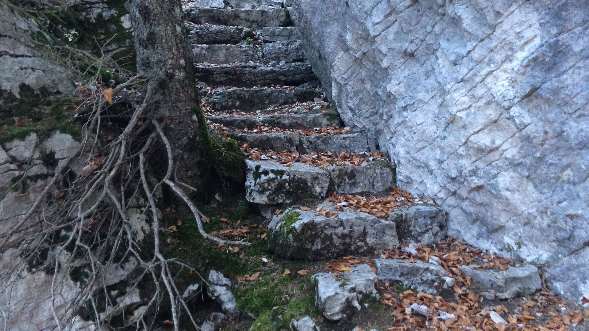
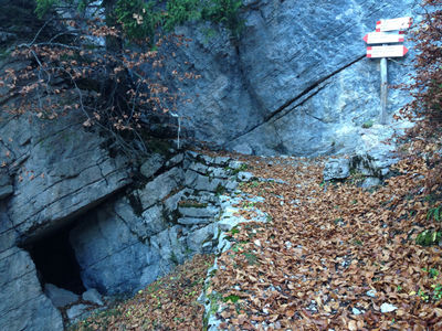
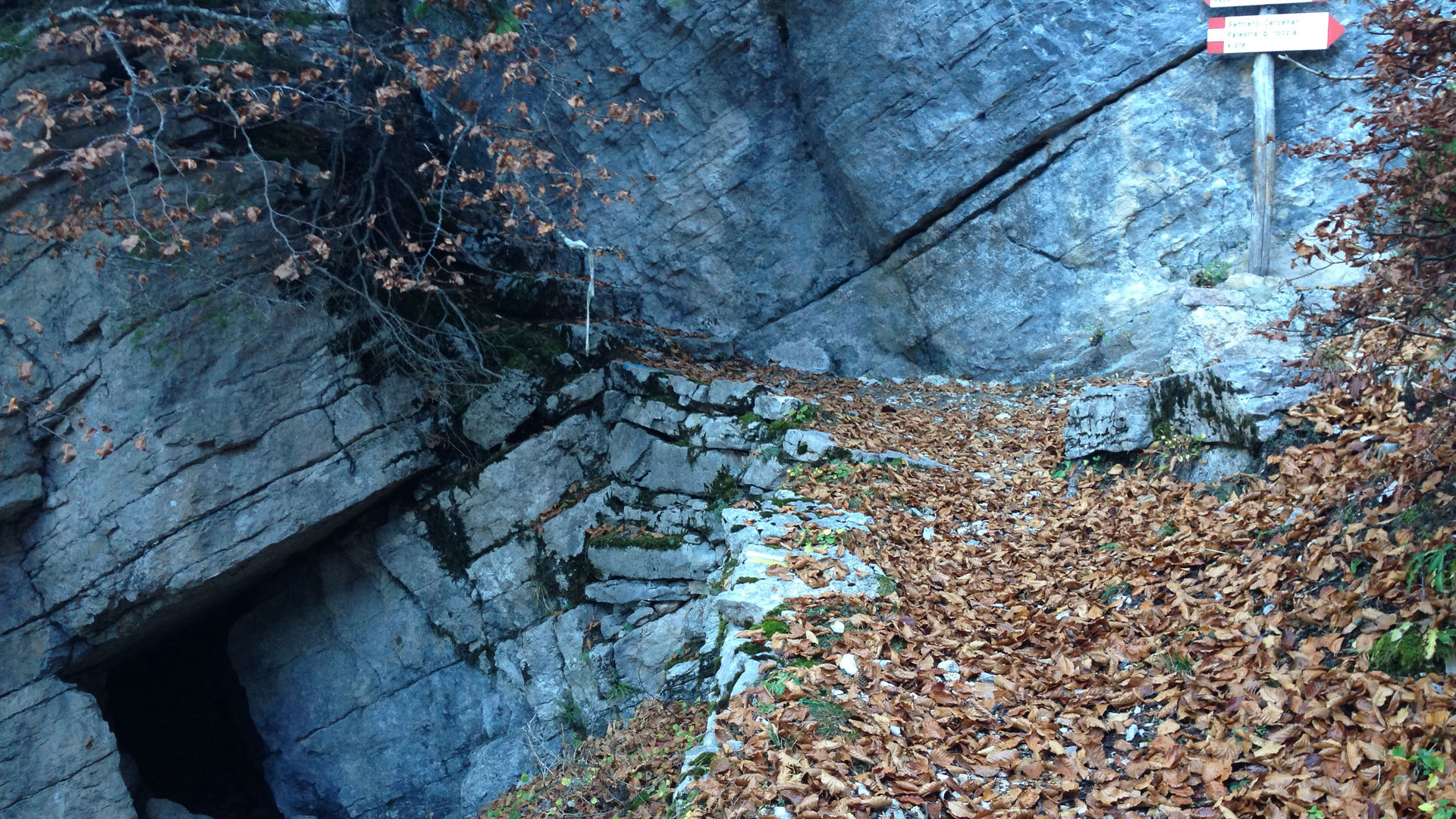
In Vaneze, to the parking lot along the provincial road, just before the Street of Còrno, you must cross the provincial road, heading north along Via dei Falchi, a street in the residential area of Vaneze. Passing the tennis courts, the road bends towards a south-westerly direction. At the bend, keep right and, a few metres on, a narrow path begins, with a sign indicating number 11, and the writing Mezavia-Vason-Brigolina- Viote. You follow this path on a slight incline until you reach a fork not far above the Selva forest road, which you can see below. The path takes the uphill direction, along the so-called Senter del Taiadic, following the signs marked with number 11. Around numerous bends, you climb - passing typical rock faces - until you reach a forest road, which you cross, continuing uphill. At an altitude of 1500 m, you come to another forest road and, heading left, this leads you to a bend in the provincial road in the village of Norge. You follow the road uphill for a few metres and, having passed a house, you head up a stairway made of wooden logs which follows the boundaries of private properties. You soon come to a sign indicating the road to follow to reach Vason. As soon as you enter the forest, there is a cave and a typical rock formation. Continuing, you travel the small valley to its end, where the path becomes flat. At the fork, it is possible to take a short detour to visit the remains of Caposaldo V/4 - ruins of trenches and defensive posts dating back to the Great War. Once you have returned to the fork, you continue in a south-westerly direction, reaching a forest road which you follow for about 600 m, until you come to signs indicating Vason-Palestra di roccia. A typical stairway is the path you must follow, with numerous bends it runs parallel to a rock face. At the first fork, characterised by a cave and an indentation in the rock face - travelled by a stone stairway - you keep right (if you go left, you follow the stairway carved into the rock face and you end up in the lower part of Vason). Continuing, you soon reach the Palestra di Roccia and Parco Avventura [Rock climbing training area and Adventure Park], dedicated to Giorgio and Rita Graffer. A short distance later, at the fork, you take the path on the left and encounter the first houses in Vason. When you reach the large parking lot, you climb the provincial road to the bottom station of the Palon cableway. From here, along the skiing slopes, you descend towards Norge and, continuing along the slopes, to Vaneze. It is possible to close the circular route in Norge, or to start it in Vason.
Learn more about the walks and trails of Monte Bondone and the Piné Plateau
Image gallery


Mappa / map / Karte
The path
Don’t miss
Trails and fortifications from the Great War, the Rock climbing training area and adventure park, and the Bondone skiing slopes
Start point

Contacts
APT Trento, Monte Bondone
Piazza Dante, 24 - 38122 Trento
Ph.: +39 0461 216000