
Time of the year: from late spring to autumn
Duration: 3 hours
Length: 10 Km
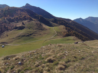
The starting point is the parking lot near the Alpine Botanical Garden and the interesting geological park. Following the fence on the western side of the Botanical Garden, first along a short path downhill and then along a dirt road uphill, the route reaches provincial road 85, which connects the Viote area to the Lagolo Lake. After crossing the road, you take a dirt road that heads into the woods and starts to climb Val d’Eva. You soon come to some ruins, the so-called “Madruzziano Castle”, the origins of which are nicely explained on the board displayed on site. Continuing, you reach the Bocca di Vaiona pass, where the view opens over the mountains of western Trentino. Here we suggest a detour, which could also become the destination of the outing, to visit the Cavedine or Roncher dairy hut, which is about 1.2 Km to the south. Along the way, you can visit the remnants of fortifications and trenches. Once you have returned, along the same road, to the Bocca di Vaiona pass, you start a short and steep climb along trail SAT 618, which leads directly to the flat meadows of La Rosta, where you can enjoy sweeping views. The path then continues uphill, heading to a plateau, and then enters a wooded valley. Continuing downhill, you cross a beech forest, until you come to a clearing where the path suddenly turns left. You leave route 618 and follow the directions to the right for the Strengiator trail, which soon leads to the Prà de la Lori, where a miniature house (la Baracca) invites you to stop for a moment. You continue along this route until you come to a dirt road, which you take to the right, in a south-easterly direction, leading to the provincial road that runs parallel a bit further down, until you meet it. You continue on tarmac until you find the road you followed on your way up, which takes you back to the Botanical Garden.
Learn more about the walks and trails of Monte Bondone and the Piné Plateau
Discover all the trekking proposals
Image gallery


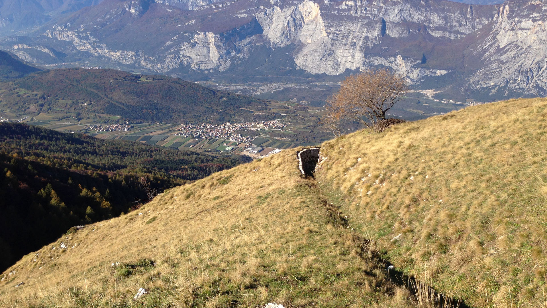
Il lago di Lagolo, visto dal percorso
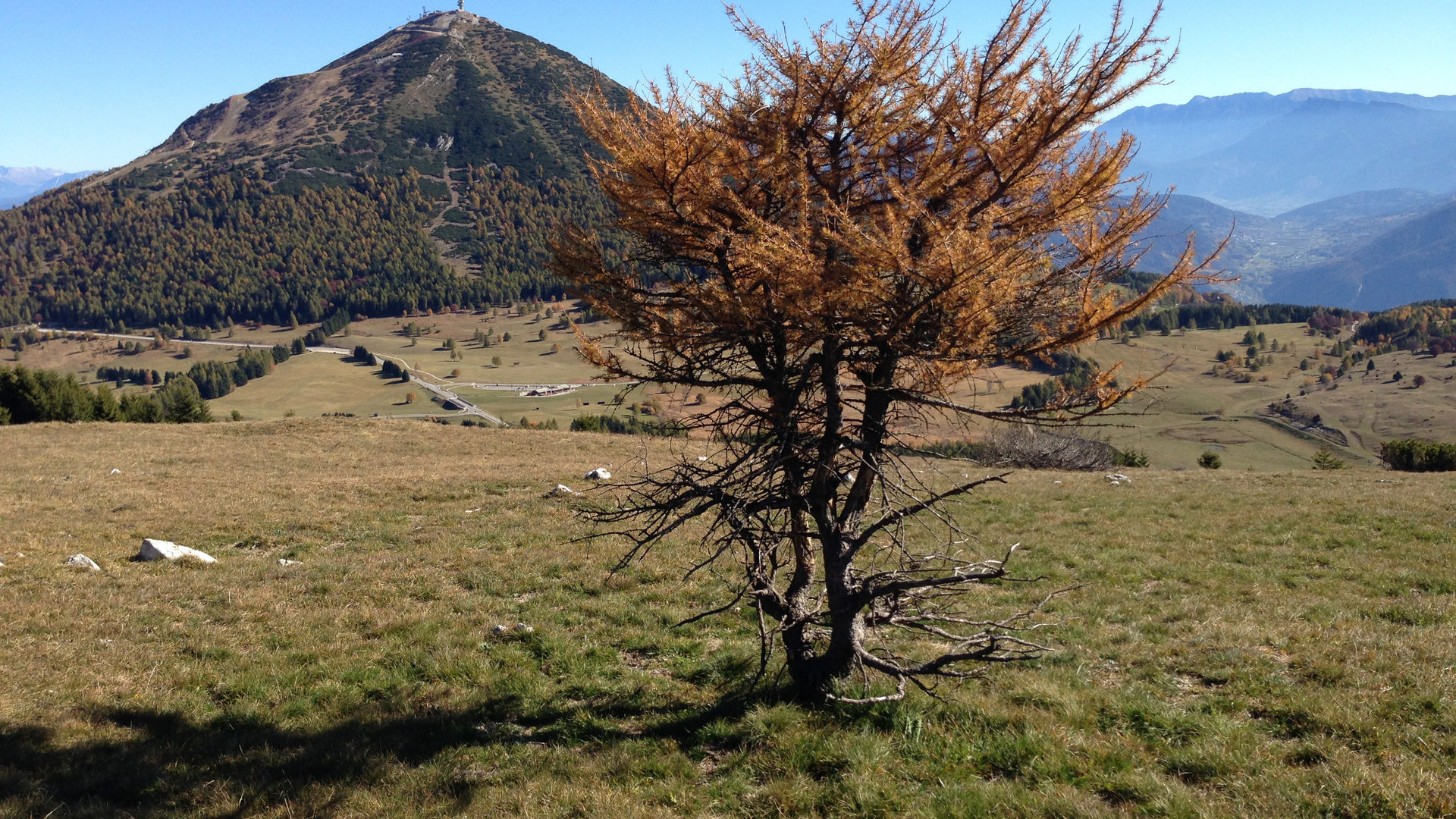

Veduta del Cornetto, da La Rosta
The path
Don't miss
The Alpine Botanical Gardens, the Madruzziano Castle, the fortifications from the Great War, meadows and woods high in the mountains, and the views.
Start point

Contacts
APT Trento, Monte Bondone
Piazza Dante, 24
38122 Trento
Ph.: +39 0461 216000