
From the square in Mattarello, a suburb of Trento that can be reached by bus, proceed south along the via Salita ai Dossi. At the end of the road are the remains of the lower battery. Continuing along the dirt road, the upper battery is also reached in a few minutes. Returning slightly back to the road, one ascends an unnumbered path to the main Mattarello work. From here, in a few minutes, path no. 447 leads to the cave work into which the fort's armoured domes were moved in 1915. The entrances are located on the right shortly after the fork with the signpost Malghetta. The return to Mattarello is via an easy asphalted road.
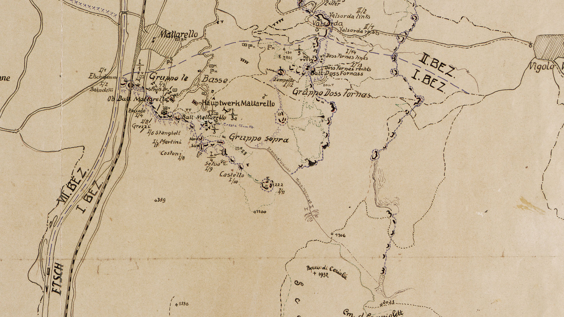
The first sector of the fortress included the village of Mattarello and went up near the hamlet of Valsorda.
Discover all the trekking routes of the Great War in Trento and surroundings.
Image gallery


The path
19th-century fortifications in Sector I
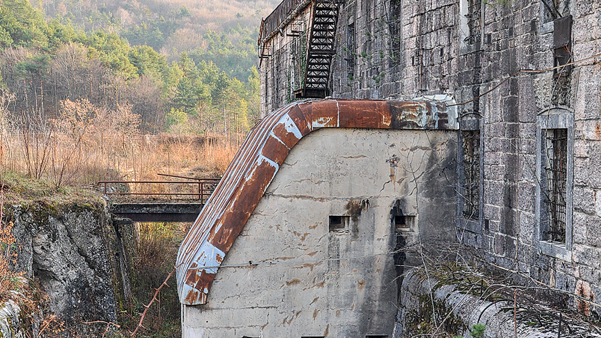
Fort Mattarello
- Year of construction: 1897-1900
- Type: Fort
- Ownership: public
- Open to visitors: no
- State of preservation: not restored
- Disarmed 1915
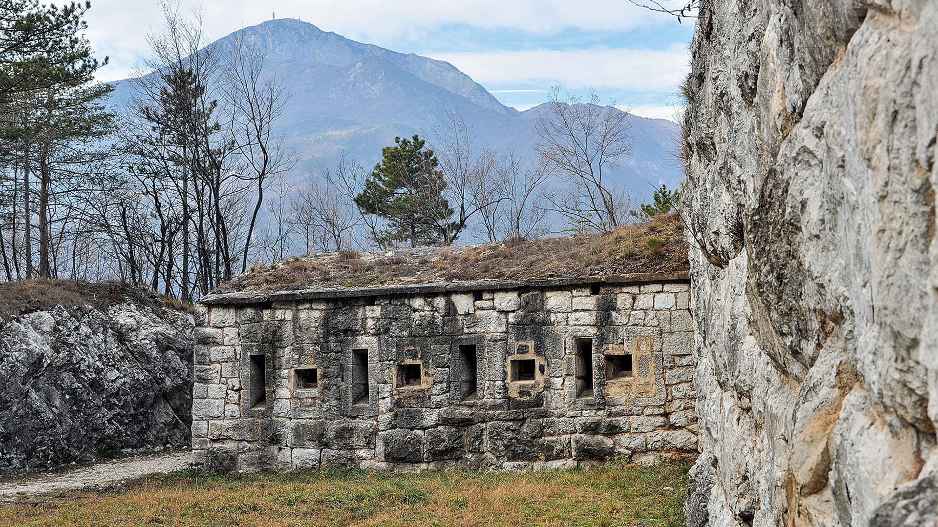
Lower battery Mattarello
- Year of construction: 1879-1880
- Type: Battery
- Ownership: private
- Open to visitors: no
- State of preservation: traces
- Disarmed 1915, destroyed 1928
Upper battery Mattarello
- Year of construction: 1879-1880
- Type: Battery
- Ownership: public
- Open to visitors: no
- State of preservation: not restored
- Disarmed in 1915
Batteria Dos Fornas
- Year of construction: 1879-1880
- Type: Battery
- Ownership: private
- Open to visitors: no
- State of preservation: not restored
- Disarmed 1915
Infos
Buy the complete guide of the routes between the First World War fortifications at our Info Office
Start point

Contacts
APT Trento, Monte Bondone
Piazza Dante, 24 - 38122 Trento
Ph.: +39 0461 216000