Time of the year: from spring to autumn
Duration: about 3:00 hours
Length: 18 Km
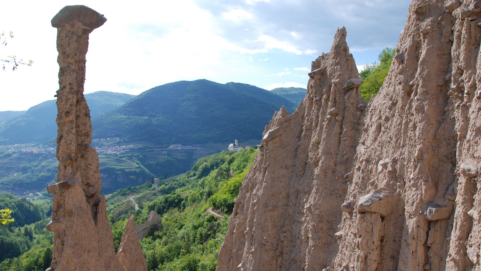
Tour that requires more effort in the first part of the route, in which you go up the entire village of Bedollo and then continue on the forest road through the pine forest leading to the now abandoned village of Gausaldo. This is the highest point of the tour. From here on it is a long descent through the forest to discover the Sanctuary of Madonna dell'Aiuto and the village of Stedro di Segonzano, with its ancient little church and view of the Avisio Valley. Two viewpoints along the paved road leading to the village of Quaras are noteworthy, offering a privileged view of Segonzano's earth pyramids, bizarre earth pinnacles topped by a large boulder.
Author’s recommendation
ATTENTION: Follow the gpx trail and directions on this page. Pushing sections from Segonzano going up by E5 trail to Marteri di Bedollo.
Don't miss the panoramic views of the Piné Plateau and its lakes from the village of Bedollo. Trail also suitable for E-MTB.
The route in detail
From Centrale, go uphill through the village of Bedollo to the hamlet of Svaldi, where the provincial road ends. It is also possible to reach the top of the village by turning into the historic centre of Bedollo following the paved road. Continue left, first on the paved road and then on the dirt road, as far as the Capitel del Frànzele. Immediately after the capital, turn right onto the mule track and, crossing the wood, reach the dirt road that climbs towards the Dosso di Segonzano. Follow it downhill for a fairly long stretch until you reach the Madonna dell'Aiuto Sanctuary. When you reach the provincial road, head towards the hamlet of Stedro di Segonzano, passing through the centre of the village and taking the road to Luc e Quaras. Here are the two observation points from above on the Segonzano Pyramids. Once past Quaras, the route becomes steeper and more demanding, with some pushing sections before reaching Marteri di Bedollo. From here, a short stretch on an asphalt road leads back to the starting point.
Learn more about the itinerary on Outdooractive
Learn more about all hiking itineraries
Image gallery


Start point

Contacts